Australian Forecast – Snow Storm Alert!!!
Published early Wednesday, 25th June 2025
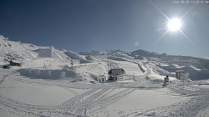
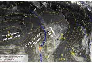
We’ve got a fair dinkum snowstorm out there, folks! After copping a beating from all that wind and rain the last couple of days, it all finally turned to snow later on Tuesday, and we’ve had solid snowfall throughout the night.
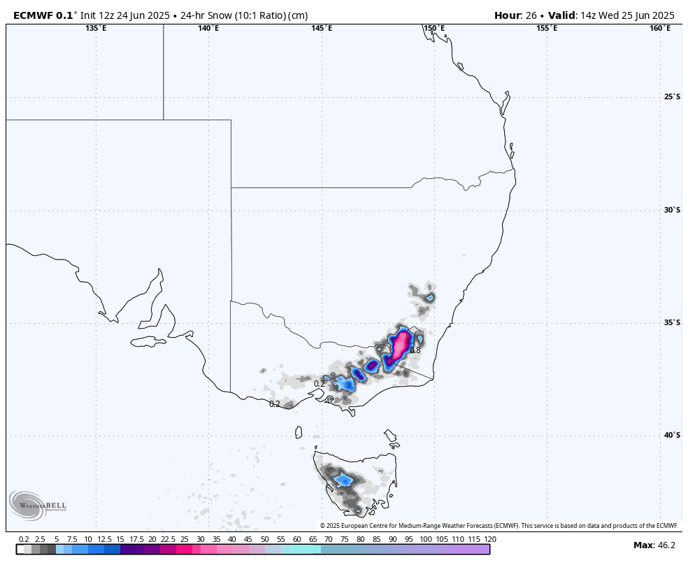
Snow will continue to fall until Wednesday evening, and by the end of the day, snow will fall to low elevations, freezing levels plummeting today as colder air moves through. 24-hour accumulations are expected to be around 30-50cm for the New South Wales resorts, 20-40 cm for Victoria, and around 15cm for Mt Baw Baw. Not only that, the weather on Friday and the weekend is going to be mint, so clear your schedule!

Wednesday 25th June
Heavy snowfall will gradually ease during the day, then clear in the evening, as gale-force northwest winds turn west then southwest. Conditions will be rough, with blizzard conditions possibly limiting lift operations again.
Thursday 26th June
A fairly cloudy day with some leftover snow flurries in the morning. Brisk, cold southerly winds gradually ease.
Friday 27th June
Mainly fine with light southerly breezes.
Saturday 28th June
Nice and sunny with light northwest breezes.
Sunday 29th June
Mainly fine and calm.
Extended Forecast
Next week is looking mostly dry, although a low in the Tasman is expected to kick up a cold southerly on Tuesday through to Thursday, which should at least keep the snow guns busy. Northwest winds will then likely pick up next weekend.
That’s all from me today, folks. I’m sending out these forecasts every Monday, Wednesday and Friday throughout the season. Have a great couple of days, and I’ll see you back here on Friday.
Grasshopper