New Zealand Forecast – Even More Snow This Week for One of the Best Starts in Years
Published early Monday, 9th June 2024
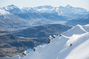
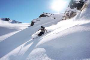
Kia ora te whanau! This coming weekend is Opening Weekend for a lot of major ski fields in Aotearoa, New Zealand, so it’s time to stay glued to the weather forecast. Conditions are looking great across the South Island after a couple of timely storms this past week brought a tonne of snow and cold temperatures.
Canterbury scored big-time, with Mt Hutt receiving 92cm during Friday night and Saturday after already receiving 10-15cm a few days prior. The Southern Lakes also had a couple of shots of powder, bolstered by a long run of good snowmaking conditions.
South Island ski fields will pick up even more snow in these final days leading up to Opening Weekend, with a few more shots of powder for the Southern Lakes, and a bigger dump likely for Canterbury Thursday into Friday. Temperatures won’t be as cold, and the snow quality not as high, but this will set us up for one of the best starts we’ve seen in a long time.

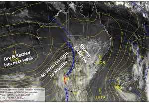
Monday 9th June
Snow will continue to fall to low levels in Canterbury through the morning, before gradually clearing in the afternoon as these polar southerlies ease. Another 5-15cm is expected throughout the region, with Mt Hutt likely sitting at the top end of that range, or even surpassing it a little.
For the Southern Lakes, light breezes and cold temps will keep the snow guns blazing throughout the day, while clouds clear overhead.
Tuesday 10th June
After another cold night making snow, South Island fields should mostly sit above cloud level as northeast breezes kick in. High cloud building later in the day will signal that something is approaching from the west.
Indeed, after dark, a front will cross the country and drop 5-10cm over Canterbury and 0.5-3cm over the Southern Lakes, with ski fields farthest west doing the best. The snow will be denser than the previous lot, possibly even a little sleety.
Wednesday 11th June
Canterbury will see a little bit of rain during the morning, then again in the evening with snow falling up high.
Snow spreads over the Southern Lakes in the afternoon as an easterly breeze develops. About 3-7cm of dense snow is expected.
Thursday 12th June
Snow develops on the upper slopes of Canterbury during the morning, then lowers to base levels during the afternoon as cooler winds from the east-southeast arrive. We could see some decent accumulations racking up.
The Southern Lakes could see some more snowfall throughout the day, but most likely it’ll clear during the early hours.
Extended Forecast
Skies will turn blue over the Southern Lakes on Friday for stunning, sunny conditions throughout Opening Weekend. Overnight temps will be nice and chilly for the snowmakers, too.
Snow in Canterbury will clear later on Friday, or perhaps early Saturday if we’re lucky, followed by clear, calm skies on Sunday. Conditions will be top shelf.
A cold southerly blast is likely to bring another dump of snow in the middle of the following week, around Wednesday 18th and Thursday 19th, which should set us up for another superb weekend as NZ starts the season on a high.
That’s all from me today, folks. I’m sending out these forecasts every Monday, Wednesday and Friday throughout the season. So, see you back here Wednesday.
Grasshopper